

Land Registry Compliant Drawings
Our Land Registry Compliant Plans can be completed with a fast turnaround to match the legal documents of your property. This includes Freehold Title Plans, Lease Plans, Boundary Plans giving a Comprehensive Service for Property Owners.

3D Laser Scanning
3D Laser scanning is technology used to capture the reality of a site, this can be used in multiple professions. It can be used in our case to map sites and buildings, or it could be used to capture a traffic accident so forensics could return to the scene years later from a PC.

Drone Surveys
Inspect roofs, document developments, or conduct property surveys with a high level of detail and in record time. That’s the power of drone imagery and videos.

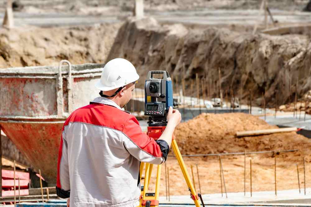
Topographical Surveys
Topographical surveys are land surveys that measure and map a piece of land’s physical features and characteristics. These features may include the terrain’s elevation, contours, vegetation, water features, and man-made structures.

As-Built Steel Surveys
As the construction journey draws to a close and settles, the significance of as-built drawings emerges. Unlike the foresight of design and the meticulousness of shop drawings, as-builts document the tangible reality post-construction.

Marine Activities Surveying
Services to meet the unique needs of vessel owners, marine construction firms, port authorities, and coastal development projects. Includes As-Built drawings for vessels, pontoons, and sea walls, Hydrographical surveys, Topographical Surveys.
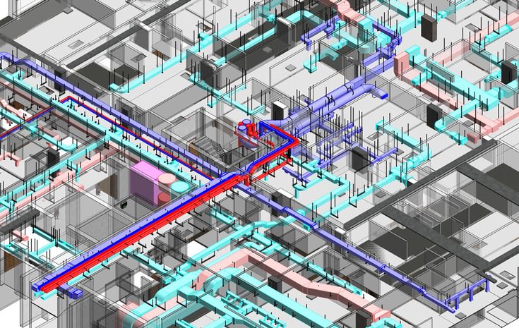
MEP Design
Dedicated to pioneering solutions and streamlined project execution. We can assist with Building information modelling, BIM management, BIM to scan, M&E design consultancy, clash detection, COBie / Asset Data management and much more.
Title Plans
We specialise in providing accurate and detailed Land Registry Compliant Title Plans tailored to meet your specific requirements. Our team of experienced professionals understand the importance of precision and compliance when it comes to land documentation. Find Out More
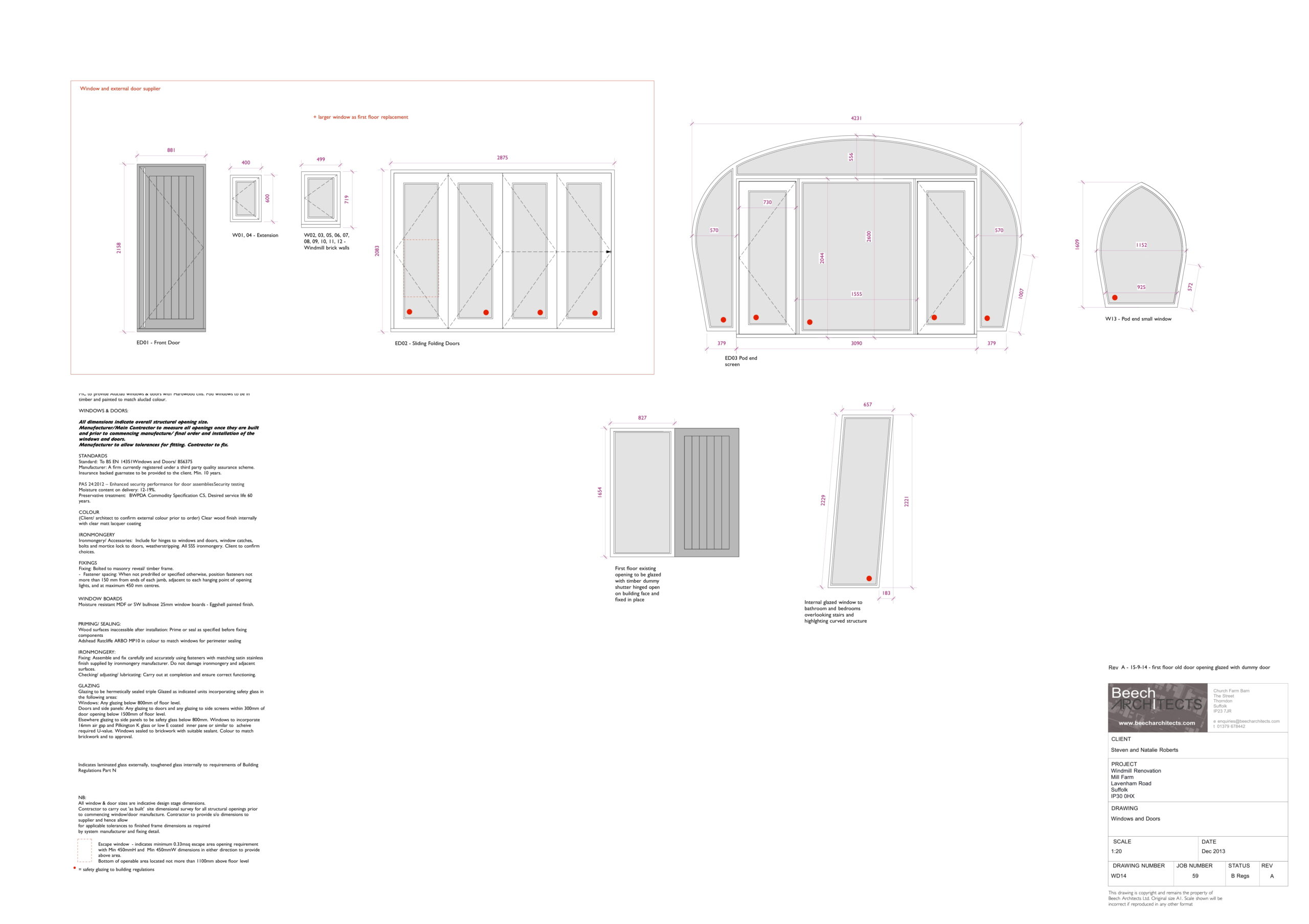
General Draughting Services
We can turn your sketches into CAD drawings or even undertake basic proposed drawings for planning permission, building regulations or Fabrication purposes. This could be in the form of tracing PDF or JPG floor plans / Elevations.

Matterport 3D Tours
Elevate your architectural vision with Matterport Virtual Tours, revolutionising your approach to design, development, and property marketing.
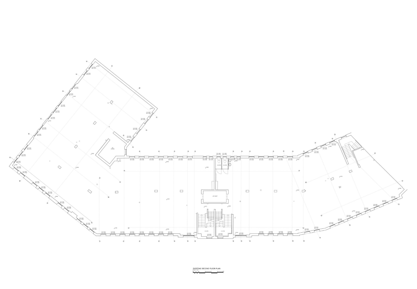
Commercial Measured Building Surveys
A comprehensive building survey is indispensable in the planning and development process for commercial properties, offering architects and engineers detailed measurements and 3D models of a building. Surveyors employ cutting-edge technology and equipment to meticulously capture accurate data, providing precise plans that encompass every aspect of the building’s structure.

Residential Measured Building Surveys
A measured building survey is crucial in the design and renovation process for residential buildings providing architects with detailed measurements and 3D models of a building’s interior and exterior. The surveyors use cutting-edge technology and equipment to produce accurate and detailed plans that capture every inch of a building’s structure.