
Topographical Surveys in Essex
Topographical surveys are land surveys that measure and map a piece of land’s physical features and characteristics. These features may include the terrain’s elevation, contours, vegetation, water features, and man-made structures. Topographic surveys are typically used to create detailed maps or plans for land development, construction, engineering and other purposes.
Bidston Draughting is a topographic survey company that provides services all across the UK, with a strong presence in Essex. Our team of skilled surveyors utilises the latest technology and methods to ensure accurate and comprehensive results for all our clients.
Our Comprehensive Method
Our professional surveyors conduct topographic surveys using specialised equipment and techniques. Some general steps involved in conducting a topographic survey are:
Research: The first step in a topographic survey is to research the property and surrounding area. This may also involve reviewing existing maps, property records, and other data sources to gain an understanding of the land’s history and characteristics.
Establish Control Points: Our topographical surveyors in Essex will establish a series of control points on the site to serve as reference points for the survey. These control points will be used to ensure that all measurements taken during the survey are accurate and consistent. The control points may be established using a combination of GPS and traditional surveying methods.


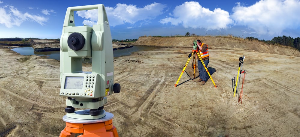
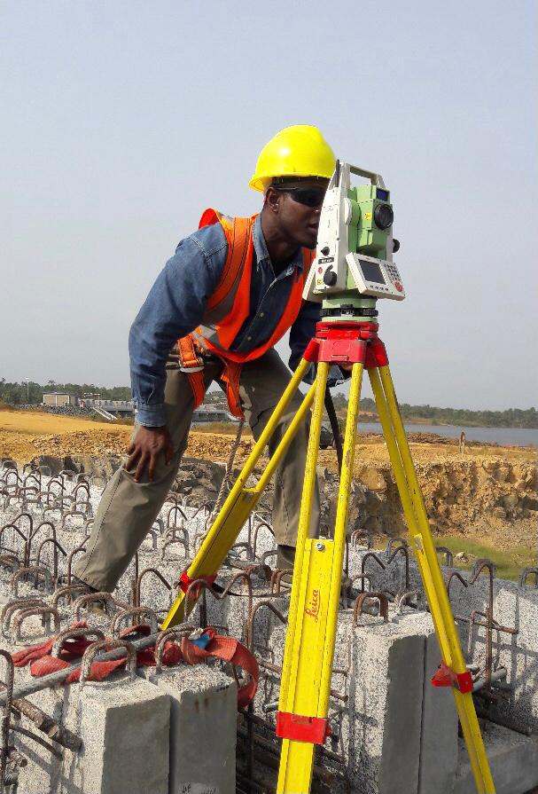
Fieldwork: Our surveyors will then conduct fieldwork to collect data about the land. This may involve using equipment such as total stations, GPS devices, and drones to measure the land’s elevation, contours, and other features. Surveyors may also take photos and notes to document any unique features or conditions.
Data Processing: After data collection, we process and analyse it to create a detailed map or 3D model of the land. This may involve using specialised software to process and analyse the data and to create a visual representation of the terrain.
Report Generation: Finally, our surveyors will generate a report summarising their findings and including the topographic map or 3D model. Based on the survey results, this report may also include recommendations for using the land.
We can help you get the surveys and drawings that you need for your projects.
Our draughting team are ready.
What Do You Get Out of It?
Topographic surveys typically include a wide range of information about the terrain and properties of a piece of land. Some of the key elements that may be included in a topographic survey are:
Elevation: Topographic surveys measure the elevation of the land, which is used to create contour lines on a map or 3D model.
Contours: Contour lines on a topographic map indicate land areas with the same elevation. These lines allow engineers and architects to better understand the slope and shape of the terrain.
Vegetation: Topographic surveys also include information about the types and locations of vegetation on the land. This information can be useful for environmental analysis and land management.
Water Features: Topographic surveys also identify water features such as rivers, lakes, and streams. This information is important for planning and engineering projects that may be affected by these features.
Man-Made Structures: Topographic surveys also include information about man-made structures on the land, such as buildings, roads, and bridges. This information is important for planning and design purposes.

When Are Topographic Surveys Conducted?
A topography survey plays a major role in an array of different projects, such as:
- Site Planning
- Building Projects
- Road Construction
- Drainage Planning
- Infrastructure Design
- Environmental Assessments
- Land Development Planning
We can help you get the surveys and drawings that you need for your projects.
Our draughting team are ready.
Bidston Draughting – Best Topographical Surveyors
At Bidston Draughting, we emphasise exceptional service and attention to detail while carrying out topographical surveys. We understand that every client has unique needs and requirements, and we strive to exceed their expectations by providing personalised solutions and customised reports. Contact us today for expert topographical survey services.
FAQs
What is the importance of a topographical survey?
A topographical survey helps provide crucial data required for project planning, land development, infrastructure design, and environmental impact assessment. It delivers detailed insights into the features and terrain of a specific site and avoids costly complications, ensuring the formation of optimised designs and overall project success.
Are topographical surveys and land surveys the same?
No, topographical surveys are different from land surveys. A land survey involves collecting data on a property’s boundaries, lines, and legal descriptions. However, a topographical survey includes mapping surface features and terrain of a particular piece of land.
Is a topographical survey required for planning a residential project?
A topographical survey is worthwhile if you plan to extend or change your home’s structure. This survey can help you identify potential challenges your residential property’s surrounding land can impose by providing detailed information on all the contours and elevations.
What are the costs associated with topographical surveys?
Typically, drawing a topographical survey costs range from £400 to £600 per day. This cost varies depending on surveying time, size of land to be surveyed, level of required details, level of accuracy needed, and land location.