
Gone are the days of flat blueprints. Now is the time to survey smarter and build better with the 3D way forward. Whether it is about urban planning, environment preservation, utility development, or other construction projects, the use of 3D modelling in surveying helps contractors and builders grasp a more realistic understanding of the physical world. Let’s understand what the phenomenon of 3D modelling is and how is it going to reshape the future of surveying and construction.
What is 3D Modelling in Construction?
In layman terms, 3D modelling is a surveying method in which specialised software is used to form explicit mathematical depiction of objects in three-dimensional space. Any 2D concepts can be turned into 3D illustrations to enable proper visualisation hence, more precise understanding. The 3D modelling technique is already being extensively utilised in diverse industries, majorly in filmmaking, healthcare, and gaming industry.
Now, the construction landscape also stands next in line to reap its diverse benefits, greatly enhancing the final project output. Developing realistic simulations, enabling animations, and envisioning graphic designs; all these construction enhancing media are improving only because of 3D rendering and modelling.
5 Ways 3D Modelling is Benefiting the Construction Industry
When you look at the continuously evolving landscape of surveying and construction, you can easily realize that 3D modelling is not just a mere part of the future; it’s the base of everything digital. Let’s see at the bigger picture:
360° Clarity for Smarter Decisions
3D modelling allows contractors to get an extensive view of any structure from multiple angles. This enables the entire team to acquire an in-depth understanding of the project and more effectively create realistic creative concepts, giving an idea of how different items will fit together.
Clearer Plans, Stronger Collaboration
With 3D modelling thoroughly representing the site layout, architects wouldn’t have to break down the intricate, technical construction process details in simple words to stakeholders. All they will have to do is to present a well-designed, lifelike 3D model using a combination of computerised design and actual site images. Instead of going on-site, contractors only have to survey a 3D-modelled construction area by using drones and conduct a comparison of the on-site work with the 3D model to forecast any incongruities.
Catch Issues Before They Cost You
As technology embeds itself deeper to facilitate the construction industry, the detection of clashes and issues in the initial stages of designing has become considerably easier. When problems are detected at an earlier stage, it helps in reducing the lead time and avoiding any potential delays. In this way, teams get the bandwidth for creating more precise 3D models, which eliminates potential issues.
Simplifying Feedback, Amplifying Results
Just like exploring other universes through 3D movies, 3D modelling in construction also gives more chances for experimenting with innovative and fresh designs. In the previous times, the major challenge was to make the client visualise the design with the help of 2D drawings. Fortunately, 3D models help everyone in better visualization of the finished project better and how it will fit into the surrounding environment.
Step Inside Before It’s Built
The realism that comes with 3D modelling is beyond anything that simple 2D images can deliver. Clients can take a virtual walkthrough of the actual building. They can view the exterior and the interior parts of the building to see how they will look before the design is finalised. 3D modelling helps in making changes to the minute details like the texture of tiles.
Methods for Creating 3D Models in Surveying
Not one, you can choose from 3 major methods to develop comprehensive, ultra-detailed 3D models that will help you easily navigate through the design process, without compromising on detailing and precision. The 3 methods are:
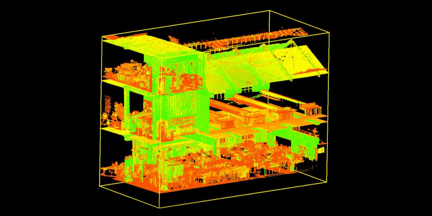
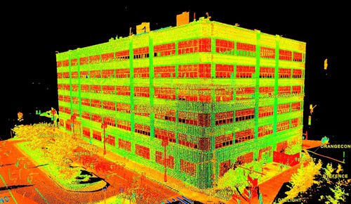
Laser Scanning
You can make use of 3D laser scanners that capture millions of data points, developing a detailed point cloud that will prove supremely beneficial to form full-scale, photorealistic 3D models. Do you know the most popular type of laser scanning method? It’s none other than LiDAR. Light Detection & Ranging is a technology that uses laser pulses to measure distances between a scanner and target surfaces to generate depth-rich 3D models.
From small rooms to large terrains, the LiDAR technology can perform next-gen rendering to create technically-precise, design-intense 3D models with an accuracy of submillimetre values to dozens of millimetres.
Photogrammetry
Photogrammetry is a totally different method to develop 3D models. In this technique, you take multiple pictures of an object from different angles under perfect lighting conditions. The images are then fed into a program that interprets them and produces true-to-scale 3D object representation.
Although you can use a camera to capture images of a simple object but when you have to capture full-scale ground-based images from the air, drones would suffice. All you need to do is use drones to capture clear images of the whole area, and the program or software to recreate larger structures.
Total Station Surveying
In this technique, you use electronic instruments to measure highly precise distances, angles, and elevations. Then you merge the functions of the electronic instrument, mainly EDM (Electronic Distance Meter), with an electronic theodolite.
Using this method, you effectively gather data and create fine-detailed, hyper-realistic 3D models for land surveying, engineering projects, and construction. The best part is that you can store and process the data directly in the field, abolishing any need for manual calculations.
Revolutionising Next-Gen Surveying with 3D Precision
Now, when you have truly understood that 3D modelling is the future, the question is, how are you planning to leverage on that? Those who timely embrace the change always stay upfront. So, there is no way you can delay embracing the multi-dimensional perks of 3D modelling.
Here’s what you can do. Reach out to a reliable company that provides the required machinery and cutting-edge technologies for acquiring visually-immersive 3D representations. Why not try Bidston Draughting? We’re professional, experienced, and reliable. Any equipment you require for surveying commercial properties, like schools, offices, and other buildings, is available with us.
You just have to state your requirements to our responsive and knowledgeable customer service team, and the rest is our responsibility. Call now at 020 3576 1705 or e-mail info@bidstondraughting.co.uk and welcome the smart future of surveying and construction through our customer-centric, future-forwarding services.