
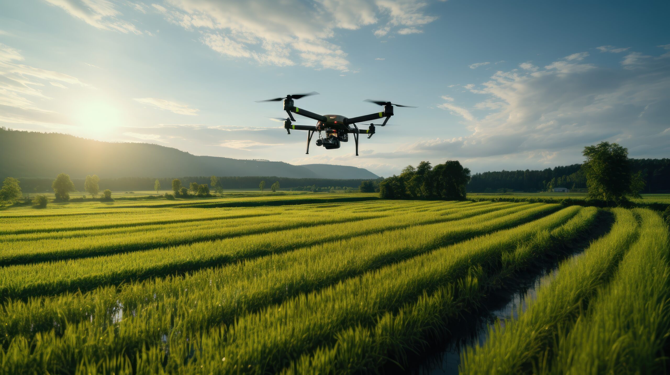
In recent years, the integration of drones into various industries has revolutionised traditional methods, and surveying is no exception. Drones have emerged as powerful tools that enhance precision and promote innovative data collection and analysis approaches. This guide delves into the critical role of drones in surveying, highlighting how they improve efficiency, accuracy, and safety in mapping and assessing landscapes. As technology continues to evolve, drones in surveying offer unprecedented opportunities for professionals and organisations, transforming how we understand and interact with our environment.
What is Meant by Drone Survey?
Surveying is the science of measuring and determining the locations and distances between points in 2D and 3D. It is worth noticing that aerial photography is different from surveying. Surveys provide essential information for making informed decisions, from planning construction to maintaining infrastructure and defining property boundaries.
A drone survey uses a drone to collect data from the air. New technology has made drone surveying more effective and economical than traditional methods. Drones have high-quality cameras, GPS, and advanced mapping software to record precise measurements and produce clear aerial images. This technology supports the creation of accurate topographical maps, 3D models, and volume measurements.
The results of drone surveys can vary depending on project needs but usually include ortho mosaic maps, digital elevation models (DEMs), point clouds, and 3D models. These outputs are crucial in various fields, helping with land measurement, construction supervision, environmental protection, and disaster management.
Types of Drone Surveys
Topographic Surveys
Drone surveys create accurate 3D maps that provide important information about the land and its features, like trees, buildings, and lakes.
Photogrammetry Surveys
Photogrammetry uses overlapping images to make 3D models from still photos, also known as 3D maps. Drone surveys that use photogrammetry are useful for measuring volume, modelling terrain, and creating detailed orthophotos.
Construction Site Surveys
Drone surveys help monitor construction progress and improve resource management. They give quick updates to keep projects on schedule and track.
Agricultural Surveys
Agricultural surveys help check crop health, determine irrigation needs, and study land to improve farming methods.
Environmental & Conservation Surveys
Drones help conservationists and land managers monitor wildlife, study ecosystems, create detailed maps of trees and plants, and monitor environmental changes. Recently, researchers have been investigating combining drone surveys with LiDAR data to estimate carbon storage in specific forests accurately. This information is important for tracking emissions and fighting climate change.
Types of Drone Surveying Sensors
When you survey with a drone, you collect more than just pictures; you also get detailed information based on your survey type. Here are the different sensors used in drone surveys.
RGB Sensors
RGB stands for red, green, and blue, the colours standard cameras use for taking still pictures. An RGB sensor is used in drone surveying to perform photogrammetry, creating detailed images of landscapes and locations.
LiDAR Sensors
LiDAR (Light Detection and Ranging) utilises laser light for measuring distances to the Earth’s surface. These sensors can easily see through dense vegetation, creating accurate 3D models of the area. Recently, LiDAR drones have changed surveying, helping archaeologists find new sites hidden by plants and providing a fast, reliable way to make 3D maps of difficult landscapes.
Multispectral Imaging
Multispectral imaging helps farmers improve crop growth. These cameras gather data from different light wavelengths to check plant health, moisture levels, and other farming details.
Hyperspectral Cameras
Hyperspectral cameras are useful for studying the environment and finding minerals. They gather data from many narrow electromagnetic spectrum bands, which helps identify materials by their unique spectral signatures.
Thermal Sensors
Thermal cameras gather infrared data to detect heat sources and show where buildings may have poor insulation or lose heat. Although thermal drones are useful for finding energy waste, detecting water leaks, or observing wildlife at night, they are not used as often for surveying as other sensors.
Benefits of Drones in Surveying
Drone surveying has several advantages over traditional surveying, many of which, as mentioned above, have fundamentally changed how surveyors work. Here are the major advantages that professionals from different industries realise from using drones for surveying.
Enhanced Accuracy
Surveyors can use drones to achieve accuracy comparable to or better than traditional methods. With high-resolution cameras, GPS, and photogrammetry, these drones collect data with millimeter-level precision.
Time Efficiency
Tasks that once took days or weeks can now be accomplished much quicker. Drones can quickly survey large areas, collecting data that would take traditional surveyors a lot longer to gather by hand.
Improved Safety
Surveying can be dangerous, involving steep hills, busy construction sites, or hard-to-reach rooftops. Drones help minimise these risks by letting surveyors gather data from a distance.
Cost-Effectiveness
Drones cut project costs by saving time, labour, and equipment during surveys, which is especially helpful for big projects.
Rich Data Insights
Drones take pictures and collect large amounts of data that can be analysed for patterns and trends. These details are important to plan projects and make decisions.
Accessibility
Drones work well in different environments and conditions, easily collecting data from hard-to-reach places that traditional methods can’t access. Whether in rugged mountains, dense forests, or cities with limited ground access, drones can do the job efficiently without needing much on-site effort.
Versatility
Drones can carry sensors, such as regular cameras, LiDAR, and multispectral cameras, making them useful for various surveying tasks. This flexibility allows one drone to perform multiple roles, such as assessing agriculture and monitoring construction sites, just by swapping the equipment.
Reduced Environmental Impact
When used for surveying, drones cause little environmental harm. Traditional surveying uses vehicles and heavy equipment, which can upset local habitats. Drones fly above, making them a more eco-friendly choice.
Applications of Drones in Surveying
Drones are useful tools for many surveying tasks. They are used in various industries, not just one. Drone surveying is already an important resource for changing industries today. Whether at construction sites, farms, or energy facilities, drones offer important information that was once hard, costly, or impossible. Let’s look at how professionals use drone surveying to solve real-world problems.
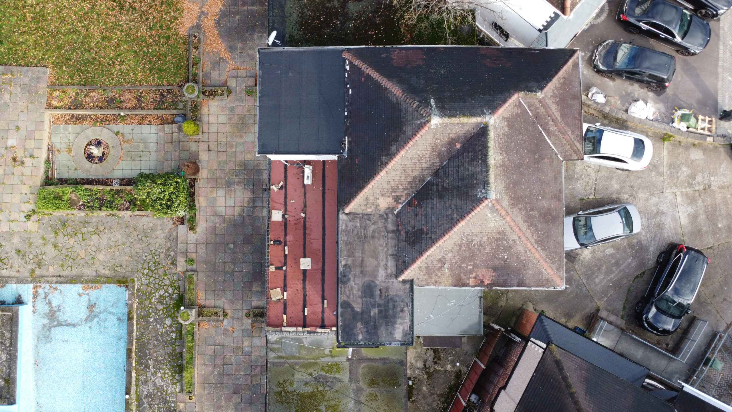
Property Inspections
Drones give property consultants and building surveyors a clear view of roofs, facades, and hard-to-reach places. This leads to faster and more thorough inspections, uncovering issues like damage, wear, or potential dangers.
Dilapidation & Condition Surveys
Drones take pictures of a property before and after tenants move in and out. This helps with planning maintenance and making damage claims.
Monitoring Progress on Construction Sites
Drones give quick updates on construction by taking aerial photos and videos. This improves communication and keeps everyone up to date.
Construction & Infrastructure Development
Drones play a crucial role in construction by helping with site analysis, monitoring progress, and making accurate terrain models. The real-time data collected from aerial surveys improves project management, reducing delays and increasing productivity.
Agriculture & Environmental Monitoring
Drones with multispectral cameras are used in farming to check crop health, identify spots that need water or pest treatment, and improve harvests. Similarly, drones help observe ecosystem changes in environmental monitoring and aid conservation efforts.
Urban Planning & Disaster Management
Urban planners use drones to map cities and gather information on zoning and infrastructure. In case of disasters, drones help assess affected areas quickly, aiding search and rescue and evaluating damage.
What Deliverables Can Be Achieved Through Drone Surveying?
The sensors and surveying software you choose will decide the results of drone surveying used in different industries.
Orthomosaic Maps
After processing, drone images are fixed for distortion and merged to create an accurate ortho-mosaic map. Each pixel contains 2D location data (X, Y) that allows for precise measurements of distances and areas.
3D Point Cloud
Drone images create a detailed point cloud with location (X, Y, Z) and colour information. This helps produce an accurate model for measuring distance, area, and volume.
Digital Surface Models (DSM)
Drone images can create elevation models for the area. Each pixel contains 2D coordinates (X, Y) and the height (Z) of the highest point at that spot.
Digital Terrain Model (DTM)
After removing buildings and other objects, drone images can be used to create Digital Terrain Models (DTMs). Each pixel contains 2.5D data, showing the highest points X, Y, and Z coordinates.
3D Textured Mesh
The 3D textured mesh reproduces the edges, faces, vertices, and texture of the area captured by the drone. This model is useful for visual inspections and engaging external stakeholders and the public, which is important for a project.
Contour lines
You can create a contour lines map using either the DTM or DSM model with custom intervals, which will help you better understand the surface captured by the drone.
The Accuracy of Drone Survey
Several factors affect the accuracy of drone survey mapping. These include the type and performance of the drone, the quality of its parts, the camera’s resolution, the altitude at which it flies, the surrounding vegetation, and the technology used for geolocating images. Under the best conditions, high-end drones can reach accuracy levels of up to 1 cm (0.4 in) and a Ground Sample Distance (GSD) of 0.7 cm/px (0.3 in/px).
Steps Involved in Drone Surveying
Planning & Preparation
Area Selection: Identify the areas to be surveyed. This helps the drone gather the necessary data for a complete dataset.
Weather Check: To get the best images and protect your drone, schedule your drone survey on a day with light winds and clear skies. Check the weather forecast one day before and again on the morning of the study.
Equipment Check: Check all equipment ahead of time to ensure your drone’s batteries are fully charged and that the sensors and cameras are working properly. When you begin, you don’t want to face equipment issues or low batteries.
Flight Planning
Determine Altitude: The altitude affects image clarity. Lower altitudes give higher resolution images but cover less area. Choose the right altitude based on your project’s needs.
Set Waypoints: Use drone software to create a flight path with waypoints, ensuring full survey area coverage.
Overlap Settings: Set a 60% to 80% overlap between images for accurate 3D models.
Flight Execution
Take off: Launch the drone from a clear area.
Monitor the Flight: Monitor the drone’s path, battery, and obstacles.
Land Safely: After the survey, land the drone in a clear area and wait for it to shut down before approaching.
Data Storage and Processing
Data Transfer: After the survey, transfer data, including photos and sensor readings, from the drone to your computer.
Software Processing: Drone software creates orthomosaics or 3D models from RGB images and processes LiDAR data into point clouds.
Create Your Report
Organise Findings: Arrange data logically, focusing on key findings first.
Visual Data: Add images and models from the survey.
Interpretation: Explain what the findings mean for the survey goals.
Recommendations: Suggest actions based on your analysis of the findings.
Onsite Data Collection
- The data collection phase starts with identifying the mission and defining the goals of the aerial survey.
- The site is assessed to gather important information that may impact data collection.
- Although optional, setting up ground control points (GCPs) can enhance aerial data accuracy; these markers are detectable in aerial images.
- Planning the flight mission involves determining the route and pattern for the drone or aircraft to capture images.
- After finalising the flight plan, data on the position and orientation system is collected, tracking the platform’s exact location and angle.
- The flight mission is then carried out to capture aerial images of the site.
Data Processing
- After collecting data on-site, the next step is data processing.
- This processing involves analysing aerial images alongside point of sale (POS) data.
- Ground Control Points (GCPs) may be used for aerial triangulation.
- Aerial triangulation is crucial as it determines the spatial layout of the photographed area from various angles for mapping purposes.
- The triangulation process is subject to a thorough accuracy check.
- If standards are unmet, optional checkpoints can be added to resolve issues.
- Once accuracy is confirmed, the process generates:
- A Digital Surface Model (DSM)
- A Digital Orthophoto Map (DOM)
- 3D terrain models
Example of Data Processing Workflow
A typical data processing workflow involves the following steps:
- Upload Images: Transfer images from the drone to a computer or cloud.
- Initial Processing: Use software to combine images and create a basic point cloud.
- Cleaning Up: Remove noise and unnecessary data points from the point cloud.
- Georeferencing: Align data with real-world locations using Ground Control Points (GCPs) or positioning data.
- Create Deliverables: Make orthophotos, digital surface models (DSMs), contour maps, and other outputs.
- Quality Check: Review final products to ensure accuracy and completeness.
This process ensures reliable results.
Conclusion
Integrating drones in surveying represents a significant advancement in precision and innovation. Their ability to capture high-resolution images, gather detailed data, and operate in environments often challenging for traditional surveying methods enhances the overall efficiency and accuracy of surveying projects. As technology evolves, drones will likely become even more essential, further revolutionising how we approach land assessment and geospatial analysis. Embracing these advancements will equip professionals to meet the industry’s growing demands while ensuring sustainable and effective land management practices.