
Topographical Surveyor London
Licensed Topographical Surveyors in London Near You
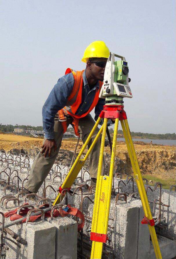
Map the land and shape your future with field-tested topographical surveys near London at market-competitive costs. From mapping ground contours to identifying features like trees, roads, and utilities, our topographical surveys provide data critical for engineering design, construction planning, grading, and site development.
As a certified, experienced topographical survey company, our detail-focused topographical surveyors utilise modernised technology to deliver precise data in numerous formats, enabling informed decision-making and preventing costly design slipups.
Fill Up the Form

Mapping the Benefits: Why Our Topographical Surveyors Matter?
Precise Planning: Our accuracy-driven topographical surveyors ensure that the project designs align with the original landscape, preventing blunders and saving costs.
Informed Design: Helping informed decision-making, our service-smart topographical surveyors provide architects and engineers with the comprehensive data required for effective site development and building design.
Compliance & Safety: Helps with coordination during construction and adherence to code and standards, particularly for municipal projects.
Environmental Considerations: Through our properly equipped topographical surveyors, we support projects for builders and constructors by providing data to reduce disruption to natural features and the local ecosystem.
We can help you get the surveys and drawings that you need for your projects.
Our draughting team are ready.
Drawing Success with Bidston Draughting LTD.
A renowned name in the surveying industry, Bidston Draughting provides topographical survey services near London with top-level precision and high-quality presentation. Our certified, industry-approved surveyors perform comprehensive surveys utilising advanced equipment like drones, 3D laser scanners, Total Station, and GPS, etc., for 99.99% accuracy.
So if you want precision on paper and clarity on site with our construction-ready topographical surveys, then call 020 3576 1705 or e-mail info@bidstondraughting.co.ukto get a quote from our local operators and to book a survey for your site. Because every great build starts with an accurate survey.
FAQs
Can I view a 3D map for my topographical survey?
Yes, you can view a 3D map of your terrain through contours, as they can effectively display 3D details in a 2D format. This means that you can view 3D information on a 2D medium. This is done through the Horizontal curved lines that link points on the map with similar elevation values, allowing effective terrain interpretation.
Why should I acquire professional help for a Topographical survey?
If you’re not confident about conducting a topographical survey or lack experience, then we suggest that you hire an expert. Even if you’ve experience, acquiring tools and knowledge to accurately perform the survey would cost you time, energy, and money. A professional, on the other hand, comes with the required tools and knows advanced techniques to perform a topographical survey error-free. You can contact our local surveyor in London for precision-driven surveys.
How much can a topographic survey cost me?
Providing a precise cost of a topographical survey is hard as it depends on several factors. This includes the time spent on performing the survey, the size of the area being inspected, and the scope of details and data that needs to be processed. You can call our local operators to get a rough estimate.
What can I expect from a topographical survey process?
On the day of your topographical survey, our professionals reach your site and map ground elevation, identify existing features, perform utility mapping, and collect spatial data and reports for accurate site analysis. This is a typical topographical survey process that our experts follow.
Bidston Draughting Ltd
Providing measured surveys throughout Essex, Kent and Greater London. Our full operations can take place anywhere in the UK and Europe, please get in touch to discuss your project.
We are insured up to £1M for public liability and professional indemnity.
Contact us Now
T: 020 3576 1705
E: info@bidstondraughting.co.uk
Offices
E: london@bidstondraughting.co.uk
E: essex@bidstondraughting.co.uk
E: kent@bidstondraughting.co.uk
VAT No. - 462695853