

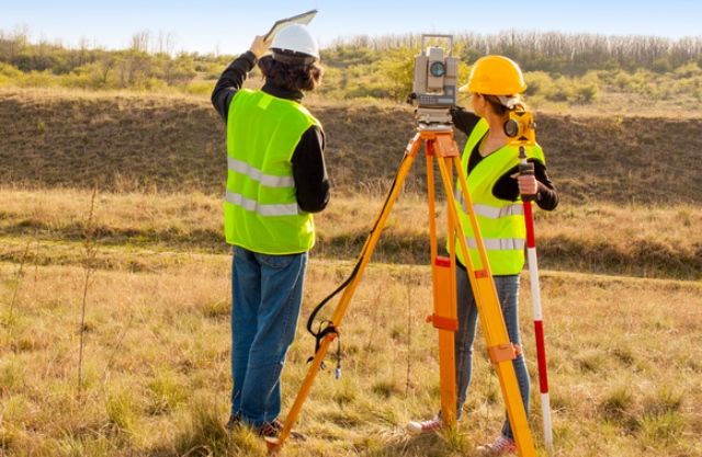
What is a Topographical Survey?
A topographical survey, also known as a land survey or a topographic survey, is a detailed survey that maps the physical features and characteristics of a piece of land. It provides accurate information about the elevation, contours, slopes, vegetation, structures, utilities, and other natural or man-made features on the land. The surveyors use specialised equipment and techniques to collect data and create a precise representation of the land’s surface.
What is the Purpose of a Topographical Survey?
The primary purpose of a topographical survey is to provide a comprehensive understanding of the terrain and its features. It is commonly used in various fields, such as civil engineering, urban planning, architecture, environmental assessment, and land development. The survey results are used to inform the design and planning processes, assess feasibility, determine the suitability of the land for construction or development projects, and facilitate accurate mapping and visualisation.
During a topographical survey, surveyors typically employ a combination of methods, including ground-based measurements and advanced surveying instruments such as total stations, GPS (Global Positioning System), and laser scanners. They collect data points regularly across the land, covering horizontal and vertical dimensions. This data is then processed and analysed to create a topographic map or digital model of the surveyed area.
The resulting topographic map provides valuable information for various purposes, such as:
- Site Planning: Architects, engineers, and urban planners use topographic maps to understand the existing conditions of a site and plan the placement of structures, roadways, utilities, and other features.
- Drainage and Grading Analysis: Topographic surveys help analyse the land’s natural drainage patterns and slopes, enabling engineers to design effective drainage systems and ensure proper grading for construction projects.
- Environmental Assessments: Topographic surveys are useful for assessing the impact of development projects on the environment, identifying sensitive areas, and planning appropriate mitigation measures.
- Land Development: Developers rely on topographic surveys to evaluate the suitability of a site for construction, assess earthwork requirements, and calculate cut and fill volumes.
- Infrastructure Design: Topographic maps assist in the design and alignment of transportation networks, utility infrastructure, and communication systems.
Overall, a topographical survey provides essential information about a piece of land’s physical characteristics and features. It is a crucial step in various industries to ensure informed decision-making, accurate design, and efficient land development.

Do You Need a Topographical Survey?
Whether or not you need a topographical survey depends on the specific requirements of your project or situation. Here are some common scenarios where a topographical survey is typically beneficial or necessary:
- Construction and Development: If you are planning to construct a building, develop a piece of land, or undertake any significant construction project, a topographical survey is usually required. It provides crucial information about the land’s existing features, elevations, and contours, which is essential for designing the project, assessing feasibility, and planning site development.
- Engineering Projects: Topographical surveys are commonly used in civil engineering projects such as road construction, bridge design, utility installations, and drainage system planning. The survey data helps engineers understand the terrain, slopes, and natural features, enabling them to design and engineer structures compatible with the land’s characteristics.
- Environmental Assessments: When assessing the environmental impact of a project, a topographical survey can provide valuable data. It helps identify sensitive areas, natural watercourses, wetlands, or other environmentally significant features that must be considered during planning and design.
- Property Boundary Determination: Topographical surveys can help resolve property boundary disputes or accurately determine the boundaries of a property. By surveying and mapping the land’s features, the survey can establish the precise location and extent of the property.
- Land Planning and Zoning: Topographical surveys play a role in land planning and zoning processes. They provide information that helps assess land suitability for specific uses, such as residential, commercial, or industrial development. The survey data assists in determining setback requirements, building placement, and other land-use considerations.
- Site Analysis and Visualisation: Even if not strictly necessary, a topographical survey can provide valuable insights and visualisation of a site’s characteristics. It helps stakeholders, architects, or designers understand the land’s topography, existing features, and potential constraints, enabling them to make informed decisions during the design and planning stages.
What Does a Topographical Survey Show?
A topographical survey provides a detailed representation of a specific land area’s physical features and characteristics. Here are some of the critical elements that a topographical survey typically shows:
- Contours and Elevations: One of the primary features of a topographical survey is the depiction of contours, which are lines connecting points of equal elevation on the land’s surface. These contours provide a visual representation of the terrain’s shape and slope, allowing for an understanding of the land’s undulations and changes in elevation.
- Natural and Man-Made Features: A topographical survey identifies and shows various natural and man-made features present on the land. This includes vegetation, trees, bodies of water (such as lakes, rivers, or ponds), streams, cliffs, depressions, buildings, roads, fences, walls, utility poles, and other structures.
- Spot Heights and Benchmarks: Spot heights are specific points on the land’s surface with their corresponding elevations indicated. These points help provide precise height references throughout the surveyed area. Benchmarks, which are permanent reference points with known elevations, may also be included to establish accurate elevation measurements.


- Slopes and Gradients: Topographical surveys show the gradient and steepness of slopes within the surveyed area. This information is essential for understanding the land’s suitability for construction, planning drainage systems, and assessing potential erosion or stability issues.
- Boundaries and Legal Descriptions: The survey typically includes boundary lines, indicating the extent and limits of the surveyed area. These boundaries help define property lines and can be helpful for legal purposes, property transactions, or resolving boundary disputes.
- Utilities and Infrastructure: Topographical surveys often depict existing utilities and infrastructure within the surveyed area. This includes underground utilities such as water pipes, sewer lines, electrical cables, gas lines, and above-ground infrastructure like manholes, utility poles, or access points.
- Quantitative Data: Besides the visual representation of the land’s features, topographical surveys may include quantitative data. This can include measurements of distances, areas, volumes, or other relevant calculations based on the survey data.
A topographical survey’s information is crucial for various purposes, including land development, construction planning, engineering design, environmental assessments, and property management. It helps stakeholders understand the land’s existing conditions, make informed decisions, and develop accurate plans for future projects.
Is a Topographical Survey Important?
Yes, a topographical survey is essential for various reasons. Here are some key reasons why a topographical survey is considered necessary:
- Accurate Understanding of the Land: A topographical survey accurately represents the land’s features, contours, and elevations. It helps stakeholders, architects, engineers, and planners comprehensively understand the land’s existing conditions. This information is crucial for making informed decisions during project design, planning, and development stages.
- Design and Planning: Topographical surveys are a foundation for designing and planning projects. Architects and engineers rely on the survey data to assess the feasibility of their designs, evaluate the impact of proposed structures on the terrain, and ensure proper integration with the natural environment. It helps them optimise the placement of buildings, roads, utilities, and other elements to work harmoniously with the land.
- Construction and Development: A topographical survey is essential for construction and development projects. It provides vital information about the land’s slopes, contours, and drainage patterns. This data helps engineers plan appropriate foundation designs, grading, and drainage systems, ensuring structural stability and mitigating potential erosion or water accumulation issues.
- Environmental Assessments: Topographical surveys play a significant role in environmental assessments. They help identify sensitive areas, such as wetlands or protected habitats, which must be considered during the planning and design stages. The survey data aids in minimising the environmental impact of projects and supports sustainable development practices.
- Property Management: Topographical surveys are crucial for accurate property management. They help define property boundaries, determine land areas, and establish precise elevation measurements. This information is useful for landowners, developers, and real estate professionals in determining property values, resolving boundary disputes, and making informed decisions about land use.
- Property Management: Topographical surveys are crucial for accurate property management. They help define property boundaries, determine land areas, and establish precise elevation measurements. This information is useful for landowners, developers, and real estate professionals in determining property values, resolving boundary disputes, and making informed decisions about land use.
- Safety and Risk Assessment: A topographical survey assists in assessing potential safety hazards and risks associated with the land’s topography. It helps identify areas prone to landslides, flooding, or other natural hazards. This information is valuable for implementing appropriate mitigation measures and ensuring the safety of structures and occupants.
- Visualisation and Communication: Topographical surveys visually represent the land’s features, allowing stakeholders to understand and communicate project requirements quickly. The survey data helps create accurate maps, 3D models, and visualisations that facilitate effective communication among project teams, clients, and regulatory authorities.
In summary, a topographical survey is essential because it provides:
- Accurate and detailed information about the land.
- Enabling informed decision-making.
- Accurate planning.
- Successful implementation of various projects.
It ensures that projects are designed, developed, and managed in a manner that considers the land’s characteristics, environmental factors, and safety requirements.