
Surveying has been, and always will be, the cornerstone of construction, agriculture, land development analysis and regulatory control. For centuries, surveyors had used extremely careful ground-based methods to measure distances, angles and elevations manually.
Traditional surveys are a gold standard for precision, but drone technology has upended the landscape — both literally and figuratively. Fast crawling aerial drone surveys can now be faster, even safer and cheaper.
But when exactly are drone surveys better than ground surveys? Read on to find out the situations, advantages and uses that make drones game-changers.
Understanding the Basics
Drone Surveys
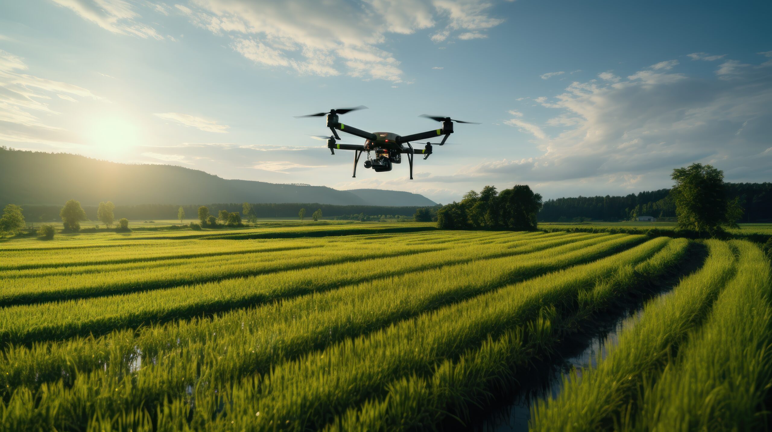
Drone-based surveys use unmanned aerial vehicles (UAVs) equipped with high-resolution cameras, LiDAR, or multispectral sensors to capture data from the air. They cover large areas at high speed, creating detailed 2D maps, 3D models and stitched aerial images. These types of surveys can be very helpful for checking difficult to reach areas, monitoring development on large projects or carrying out infrastructure assessments with minimal disruption.
Ground Surveys
Surface surveys are done with modern instruments such as total stations, theodolites and GPS. Surveyors walk over the land to determine the lengths, angles and elevations. These techniques are highly accurate, particularly for small projects or legal boundary definitions, but are slow and expensive.
Key Factors That Make Drone Surveys Stand Out
A number of considerations affect whether drone surveys or ground-based methods are the best one for your project. Everything from speed and price to safety and environmental impact. Here’s what you need to know to help pick the right method for your project, and to discuss the primary factors that make drones a better option.
-
Speed and Efficiency
One of the clearest benefits provided by drone surveys is speed. A drone can collect high-resolution data for hundreds of acres in a day — a job that could consume a ground survey crew for weeks. Such a quick turnaround is useful for construction sites that require frequent updates, for farming monitoring across large fields, or for disaster inspection scenarios.
Even ground surveys, however well they’re done, can’t possibly keep up with this pace. The process of gathering measurements by hand involves setting up equipment, walking over uneven surfaces and double-checking numbers, all of which takes time.
-
Cost Considerations
Time saved is money saved. Drone surveys are often more cost-effective than ground surveys, as they require less manpower, equipment and time for project completion. Even on small projects, the labour cost savings and the reduced need for costly on-site machinery are significant.
Ground-based surveys, however, inevitably require larger crews and longer field days – and therefore require higher labour and equipment costs. And for large projects, this difference can be particularly pronounced.
-
Safety Advantages
Drone surveys are inherently safer. Land developers can gather data from above without entering dangerous environments, including unstable construction sites, steep slopes, or active mining areas. Remote working allows mitigating risks from accidents, injury and any harmful environmental exposure.
Practice surveys on the ground usually require human presence at dangerous sites, which can lead to accidents. For dangerous or hard-to-reach places, drones confer an obvious safety benefit.
-
Accuracy and Precision
Today’s drones are now fitted with RTK (Real Time Kinematic) GPS and high-quality sensors that translate to sub-centimetre-level accuracy in good conditions. Ground surveys still have the upper hand for super-precise work, such as legal boundary measurements or specific structural layouts. Still, drone surveys do the job more than well for most commercial and industrial applications.
For many applications, however, a combination of these two methods — drones for quick data capture, ground surveys to verify it for the best results.
-
Accessibility and Versatility
Drones are great for getting into places that are hard — or even impossible for people to reach. Drones can gather precise aerial data from dense forests and steep mountain slopes to water bodies and rugged terrain without surveyors having to place themselves in danger.
But ground-based observations are restricted by real estate, weather and logistics. Elevated gradients, rivers or dangerous construction areas can delay or otherwise prevent manual possibilities for data acquisition.
- Construction: Inspecting roofs, high tower construction sites and other hard-to-reach scaffolding.
- Agriculture: Watching over crops on big, uneven fields or at remote farms.
- Mining & Quarrying: Inspecting unsafe pits, faces and stockpiles.
- Environmental Monitoring: Observe wildlife, map wetlands and study forests without disturbing natural ecosystems.
The coverage of reach, flexibility and efficiency attributes makes drones an incredibly powerful tool in many sectors.
-
Environmental Impact
The environmental impact of drones is relatively small. They consume only a little energy, avoid heavy thermal machinery and don’t disturb the ground as they gather data. This makes them environmentally friendly for surveying those delicate sites, such as protected landscapes or wildlife habitats.
Ground surveys can contribute to higher direct and indirect environmental impacts due to soil effects from ground vehicles or long-term fieldwork exposure.
Limitations of Drone Surveys
Drones provide many advantages, but they have limitations as well. The following are the scenarios where classic ground surveys might still be necessary:
- Weather Problems: Flights can be delayed or cancelled due to rain, high winds, or fog.
- Difficult to Access: Deep woods, inside a building or areas with poor GPS signal.
- Rules: Permission required from authorities such as CAA (UK) or FAA (US).
- Skills Necessary: It takes an expert to safely fly a drone and make this data into accurate maps or models.
By comparing these constraints against the advantages, project managers can determine whether drones, ground surveys or a mix of both is ideal for their goals.
Choosing the Right Method
In the end, the choice between drone and ground surveys comes down to your project:
- Opt for drones if you value speed, safety, cheaper cost and accessibility. They won’t have any problems with large surfaces, danger areas or if you need to take control over and over again.
- Opt for ground surveys when there is no room for error, whether on small or complex projects where a high level of detail is needed, or on legally sensitive projects.
Increasingly, the best results are achieved by combining both approaches — beginning with drone surveys to gain an overview and then supplementing that information with targeted ground measurements.
Conclusion
Drone surveys are revolutionizing the surveying world, providing speed, safety, cost savings and accessibility that traditional ground surveys can’t always deliver. They are well-suited for large spaces, contaminated locations, and where frequent checking is needed.
But when it comes to absolute accuracy, especially if you’re working on a small-scale, detail-oriented or legally significant project, ground surveys have their place. In some cases, the two methods work best in combination, making use of drones to be efficient and ground measurements to be accurate.
By learning what to expect and when to use each method or to combine them, depending on your project’s goals, needs, schedule and budget, you can become a master of robust, actionable data.