Introduction
Measured surveys have long been an essential part of building design and construction, providing accurate and detailed information about a site or building. With advances in technology, the future of measured surveys is set to be exciting and innovative. In this post, we will explore some of the latest trends and advancements in measured survey technology and predict what the future of the field might look like in the next five years.
- Increased Automation:
One of the most significant trends in measured survey technology is the increasing use of automation. As laser scanning and photogrammetry tools become more sophisticated, it is becoming possible to automate many of the tasks involved in measured surveys. This includes everything from data capture to data processing and analysis.
For example, some companies are now using automated laser scanning drones to survey large sites quickly and accurately. These drones can capture data in a fraction of the time it would take a human surveyor to do the same job, making them an excellent choice for large-scale projects.
- Improved Accuracy:
Accuracy has always been a key consideration for measured surveys, and the latest advancements in technology are making it possible to achieve even greater levels of precision. Laser scanning, in particular, has made significant strides in recent years, with high-density scanners now capable of capturing millions of data points per second.
This level of accuracy makes it possible to create incredibly detailed and accurate 3D models of buildings and sites. This data can be used for everything from building design to historical preservation and restoration.
- Integration with BIM:
Building Information Modelling (BIM) is a process that involves the creation of a digital model of a building or site. BIM models contain information about the physical and functional characteristics of a building, and they are used by architects, engineers, and contractors to plan and manage construction projects.
Measured surveys are an essential part of the BIM process, providing the detailed data needed to create accurate digital models. As BIM continues to grow in popularity, the integration of measured survey data into BIM models is set to become even more important.
- Virtual Reality:
Virtual reality (VR) is a rapidly developing technology that is set to have a significant impact on the measured survey industry. With VR, it is possible to create fully immersive 3D environments that can be explored in detail.
This technology has the potential to revolutionize the way that measured surveys are conducted and analyzed. By creating virtual replicas of buildings and sites, surveyors can explore and analyze them in ways that were previously impossible.
- Mobile Mapping:
Mobile mapping is a technique that involves the use of vehicles or mobile devices, such as cars and drones, to capture data about a site or building. This data can be captured using a range of sensors, including cameras, GPS, and accelerometers.
Mobile mapping is an exciting development in the measured survey industry, as it makes it possible to capture data quickly and easily in a wide range of environments. This technology has particular applications in outdoor environments, where it can be challenging to capture accurate data using traditional surveying techniques.
Conclusion:
In conclusion, the future of measured building surveys is set to be exciting and innovative. Advances in technology are making it possible to achieve even greater levels of accuracy, automate many of the tasks involved in surveying, and integrate survey data with BIM models. Virtual reality and mobile mapping are also set to have a significant impact on the industry in the coming years. By embracing these new technologies, measured survey companies will be well-positioned to provide their clients with even more accurate and detailed information about their buildings and sites.
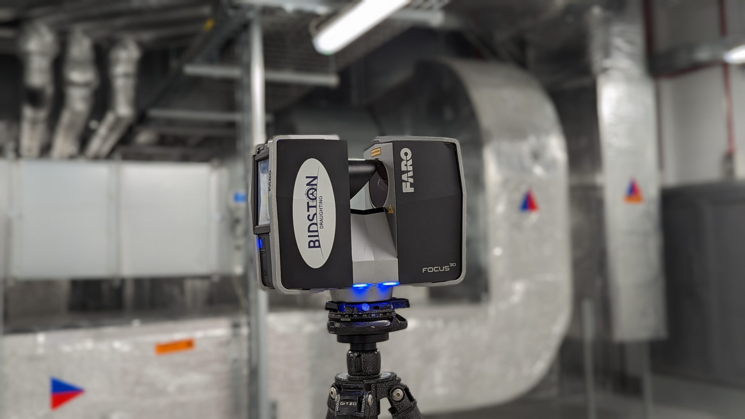
Our Current method of Data Capture:
Faro Technologies – FARO Technologies is a company that provides advanced 3D measurement and imaging solutions, including laser scanners and software. They offer a range of products designed for various industries, including architecture, engineering, and construction. Their solutions can help users capture, analyze, and use data to improve productivity, quality, and safety.
We currently operate Faro’s laser scanners & scene registration software and look forward to watching them advance in the near future to see how they can help us all capture more reliable & accurate data on measured surveys.