
The cost of measured building surveys ranges between £600 and £1,500+, depending on the property’s size, layout complexity, location, and required drawings.
Any construction work on a property requires accurate measurements for successful, streamlined project planning. In order to produce precise measurements, a measured building survey offers accuracy and efficiency that traditional measurement methods can’t match. From a simple floor plan for small renovations to a complex, detailed 3D model for commercial projects, these measured surveys form a comprehensive digital representation of the structure. But the big question is: what is the cost of a measured building survey?
The cost of a measured building survey depends on more than just forming a virtual version of your building. Property size, building complexity, location, level of detail required and access and site conditions all influence the final price. This guide includes everything you need to know to make sure you get the best price for a measured survey.
Fill Up the Form
What is a Measured Building Survey?
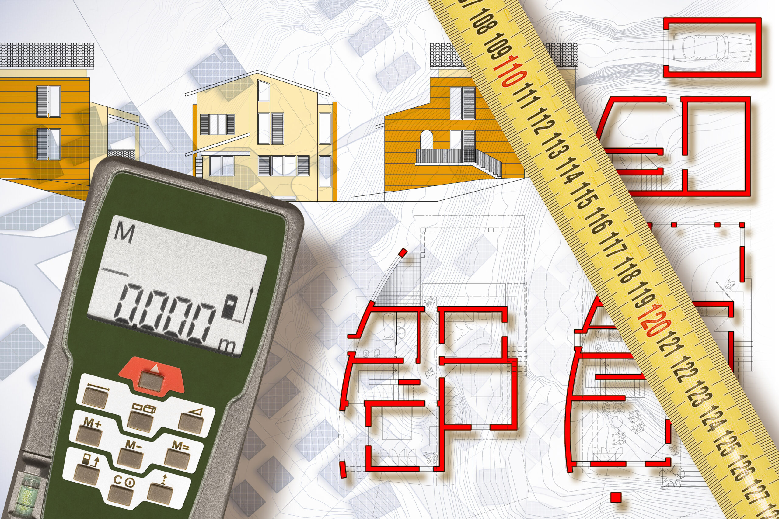
A measured building survey is a precise method of capturing a property’s dimensions, layout, and structural details to create accurate technical drawings. It provides a reliable foundation for design, renovation, and construction projects, ensuring all decisions are based on real, verified data rather than assumptions.
Modern surveys use advanced tools such as 3D laser scanning to collect detailed information quickly and efficiently. This data is then used to produce outputs like floor plans, elevations, sections, and sometimes 3D or BIM models, depending on the project requirements.
In simple terms, a measured building survey gives you a complete and accurate representation of your existing property, helping to reduce errors, avoid costly mistakes, and support smoother project planning from start to finish.
How Much Do Measured Surveys Typically Cost?
A lower price shouldn’t be the first thing you look for! Every job is different and costs differently. The quote for measured surveys is generally generated based on the time required, travel expenses, equipment, software use, and labour.
It is recommended that you should compare different packages and the information you get to make the right decision before hiring a professional surveyor for measured surveys. To make it clearer, here is an example of fees for fairly standard measured building surveys:
At Bidston Draughting, a rough idea of costs for a measured building survey in 2026 can be found below:
- 3-bedroom house – floor plans – £800
- Floor plans + elevations – £1100
- Full drawing package – £1300
- Topographical survey – £1250
What Influences the Cost of Measured Building Surveys?
A measured building survey produces precise technical drawings like elevations, sections, and floor plans. The quote for a measured survey is primarily determined by several factors, including:
Property’s Size
The survey for larger properties commands more time and resources to capture the total volume of data in square meters.
Building Complexity
A complex building structure, like a heavily partitioned office or a heritage site take significantly more time to survey than an open-plan warehouse.
Level of Details Required
Detailed architectural drawings, including lighting fixtures, fittings, and decorative mouldings, cost more than basic 2D outlines for floor planning.
Location (London vs. the Outskirts)
Measured surveys in London generally incur a higher cost than in the outskirts, driven by higher demand, travel, complex health and safety induction, or out-of-working hours.
Access Method And Site Conditions
Large-scale, intricate architecture with restricted rooms and high occupancy may take longer to survey and cost more than sites with fewer constraints.
What Do You Get for the Price?
A measured building survey usually results in a set of documents and files that comprehensively explain the building’s condition. Here are the common features typically included:
- Floor Plans: Detailed floor plans are drawings of every floor of the building. They show the location of internal walls, door position, window position, staircases, and other internal elements in their exact location
- Elevations: The sketches from the outside of the building are elevations. These sketches show every side and detail, including height, width, and position of the building in relation to its surroundings.
- Sections: A section is a vertical or horizontal view of the building, showing how the walls, floor, and ceiling connect. These drawings show the interior layout, ceiling height, floor height, room setup, and the location of structural elements. These sketches help understand the building’s vertical layout and the spaces inside it.
- 3D Models: 3D models are interactive digital models which can be viewed on a computer. These models include all the information in an engaging spatial arrangement, from the floor plans, elevations, and sections, rather than plain sketches.
How Is a Measured Building Survey Carried Out?
A measured building survey is carried out by following a step-by-step process to deliver accurate, reliable results. As a property owner or professional, understanding these help know what you can expect from this process.
Initial Consultation
The process of a measured building survey starts with a detailed discussion between the client and the surveying company. The surveyors will arrange a consultation session to discuss the project details and record the specific requirements of the client.
Site Visit
After the detailed initial consultation, the surveyors will conduct a site visit to take the precise measurements. The surveyors are professionally trained to inspect the property and use specialised tools to capture accurate data quickly with minimum risks of errors.
Data Capture
The surveyors use the 3D laser scanner for collecting millions of points of data. A 3D laser scanner is used as the primary tool to quickly capture the data, providing a detailed digital record of the property. The benefit of using this method is that additional measurements can be obtained later from the saved point cloud, eliminating the need for another site visit and saving both time and money.
Delivery of The Final Drawings
Upon site survey and data collection completion, the surveyors provide the drawing to the client in accordance with the project’s specification, whether in CAD, PDF, or BIM format. This final record of the survey acts as a precise depiction of the building for planning, designing, and construction. Surveyors will confirm that the data within each document is accurate and identified for the proper use in subsequent phases of the project.
How Long Does a Measured Survey Take?
A measured building survey today uses high-tech tools to collect data accurately and quickly. The duration for data collection during surveys depends on:
- Small House: The timeline of a measured building survey for a small house with a simple layout, fewer rooms, walls, windows and doors is typically 1 day.
- Medium-Sized Property: Medium-sized properties frequently combine higher complexity, irregular layouts, and higher levels of details that require extensive on-site scanning and post-processing. The duration for surveying such properties ranges between 1 and 2 days.
- Drawings Delivery: Measured building survey drawings often take a few days after collecting data to deliver because the process requires meticulous post-processing to turn raw, on-site data into accurate, usable CAD drawings or 3D/BIM models.
How to Choose the Right Surveyor?
For choosing the right surveyor, it is vital to look for their knowledge, expertise, and the type of surveying techniques they specialise in. Here are some ways which can help you in identifying the right surveyors:
Experience
You should look for the surveyors who have a proven track record in the relevant type of surveying work you require. Surveying work involves a full property survey, valuation, project management, boundary surveys, topographic surveys, and a specialist witness. So, make sure they can do what you need.
Equipment
The equipment and technology used in a measured building survey highly influence the efficiency and accuracy of the required property’s survey. For example, the use of drones and GPS systems allows the surveyors to provide more accurate measurements, marking corners on detailed surveys to ensure comprehensive project planning.
Insurance
Insurance acts as the representation of quality control, technical competence, and professional accountability to help choose the right measured building surveyor. Measured surveys involve precision, where errors can lead to expensive project delays or construction mistakes. So, hire reputable surveyors with specific insurance for protecting your property and avoiding unnecessary costs.
Reviews
Reviews are critical in choosing the right surveyor for a measured building survey. They offer independent validation of a surveyor’s accuracy, reliability, and technical proficiency. For a measured survey, which produces detailed floor plans, elevations, and sections, reviews help ensure the surveyor uses modern, precise equipment like 3D laser scanners and BIM technology.
Measured Survey Costs in London & Surrounding Areas
Measured building surveys costs vary across different areas of the UK:
London Pricing Trends
Measured building survey costs in London in 2026 are trending higher than the UK national average, typically costing 25%–40% more due to high demand and logistical complexities. Standard professional surveys in London often start around £495–£800 for small projects, while residential projects with 3-4 bedrooms commonly cost between £800 and £2,000.
Berkshire / Essex Mention
Measured building survey pricing in Berkshire and Essex in 2026 is trending upwards, driven by high demand for renovation, 3D laser scanning technology adoption, and premium operating costs in the Southeast. A typical small residential survey for a 2-3 bed house in these areas generally falls between £800 and £2,000, with costs often 25–40% higher than the UK national average due to proximity to London.
Why does location impact cost?
Location significantly impacts the cost, primarily due to travel time, accommodation expenses, and operational costs in high-density areas like London. Site-specific environmental factors, urban density and regional differences influence the demand for the survey, which in turn affects the cost of a measured building survey.
FAQs
How much does a measured building survey cost in the UK?
Measured building survey typically costs between £600 and £1,500+, depending on the property’s size, complexity, location, and required drawings.
Do I need a measured survey to obtain planning permission?
Measured building survey offers accurate data, which is necessary for planning permission for all building extensions, new builds, and significant modifications. These surveys guarantee compliance with local building regulations, property boundaries, and other structural constraints.
What drawings are included in measured building surveys?
A measured building survey includes the different types of drawings, including floor plans, elevations, sections and 3D models.
How much time is required to complete a measured building survey?
The duration of a measured building survey for a small house typically takes 1 day, and for medium size property it takes 1 to 2 days.
How can I save costs on a measured building survey?
Yes, the cost of measured building survey costs can be reduced by negotiating the scope to only necessary data, preparing the property for easy access, and using 2D drawings instead of 3D models.
Need A Measured Survey?
If you are planning renovations, revamping an office or safeguarding a heritage building, choosing the professional team for your measured building survey is important. Bidston Draughting has an in-house team of skilled surveyors who combine expertise with state-of-the-art tools to deliver accurate, reliable and detailed surveys. Discuss your project’s requirements and receive a fast, no-obligation quote from our expert surveyors.
Get an Accurate Measured Survey Quote Today!